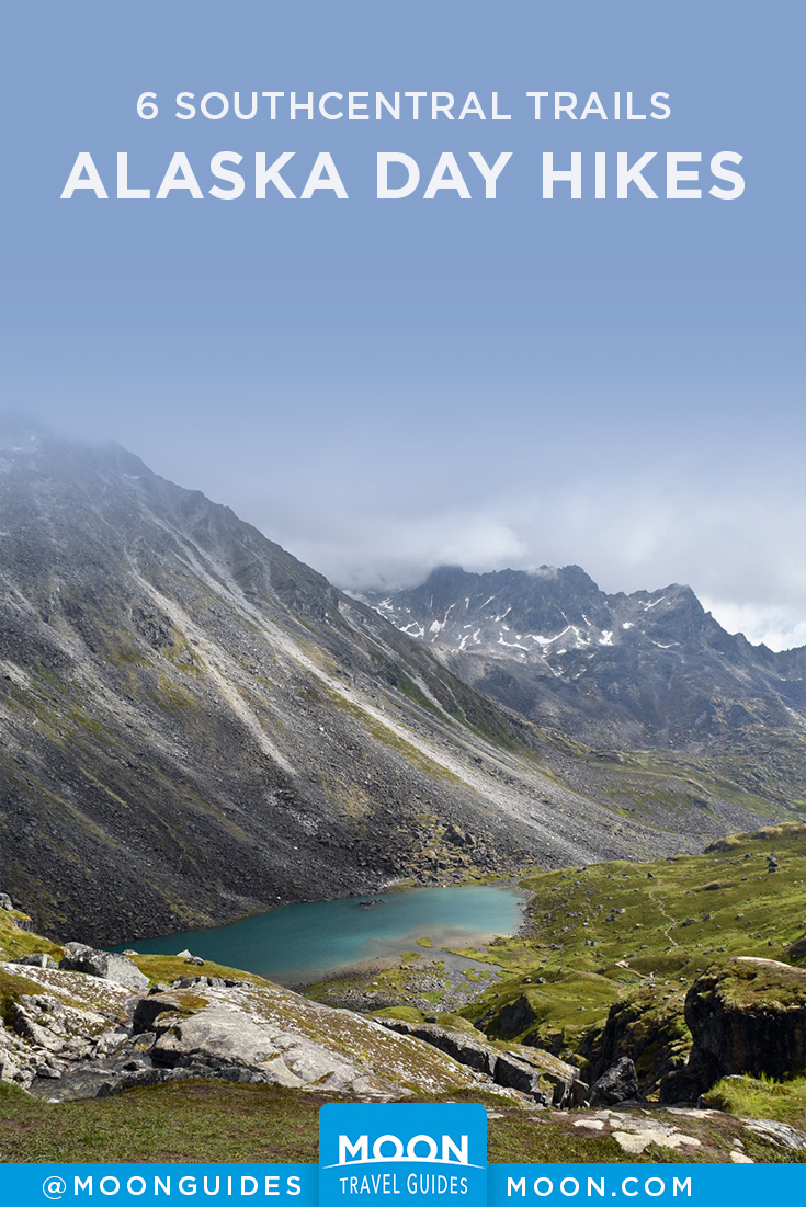
The 6 Best Day Hikes in Southcentral Alaska
As much as people come to Alaska to see bears, moose, and eagles or catch gigantic fish, it’s the sprawling, untouched wilderness landscapes that best define this iconic land. But you don’t have to go far to get a taste of Alaska’s beauty; check out these 6 day hikes all within an easy drive of at least one community. These treks (listed by difficulty, starting with the easiest) will truly immerse you in the wild grandeur that defines Southcentral Alaska.
The Trail of Blue Ice
This 5-mile multi-use trail links all the developed recreation areas in Portage Valley, offering stunning views of hanging glaciers on the mountaintops all around. Its combination of pavement and hardened gravel makes for a lovely stroll or bike ride, and a short detour around the only steep hill makes it completely accessible for travelers with disabilities. The trail starts at the Moose Flats Day Use Area at mile 1 of the Portage Highway and ends at the shore of Portage Lake, just outside the Begich, Boggs Visitor Center.
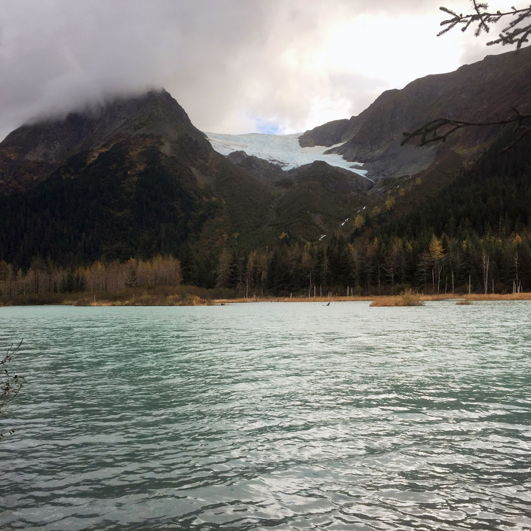
Portage Pass
If you only have time for one hike in Southcentral, make it this one. Sure, you’ll have to go through the longest combined vehicle/railroad tunnel in North America to get to the trailhead in the quirky old military town of Whittier, but that’s part of the fun. Even if you only hike the .8 miles to the top of the 800-foot pass, you’ll be treated to views of Portage Glacier in the distance and the crystal blue waters of Passage Canal behind you; another 1.7 miles gets you down to the lakeshore, directly opposite the glacier.
Pro tip: Bring a picnic lunch with you. If you’re lucky, you might get to see the glacier calve before you hike back.
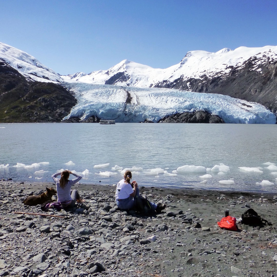
Grewingk Glacier and Saddle Trail
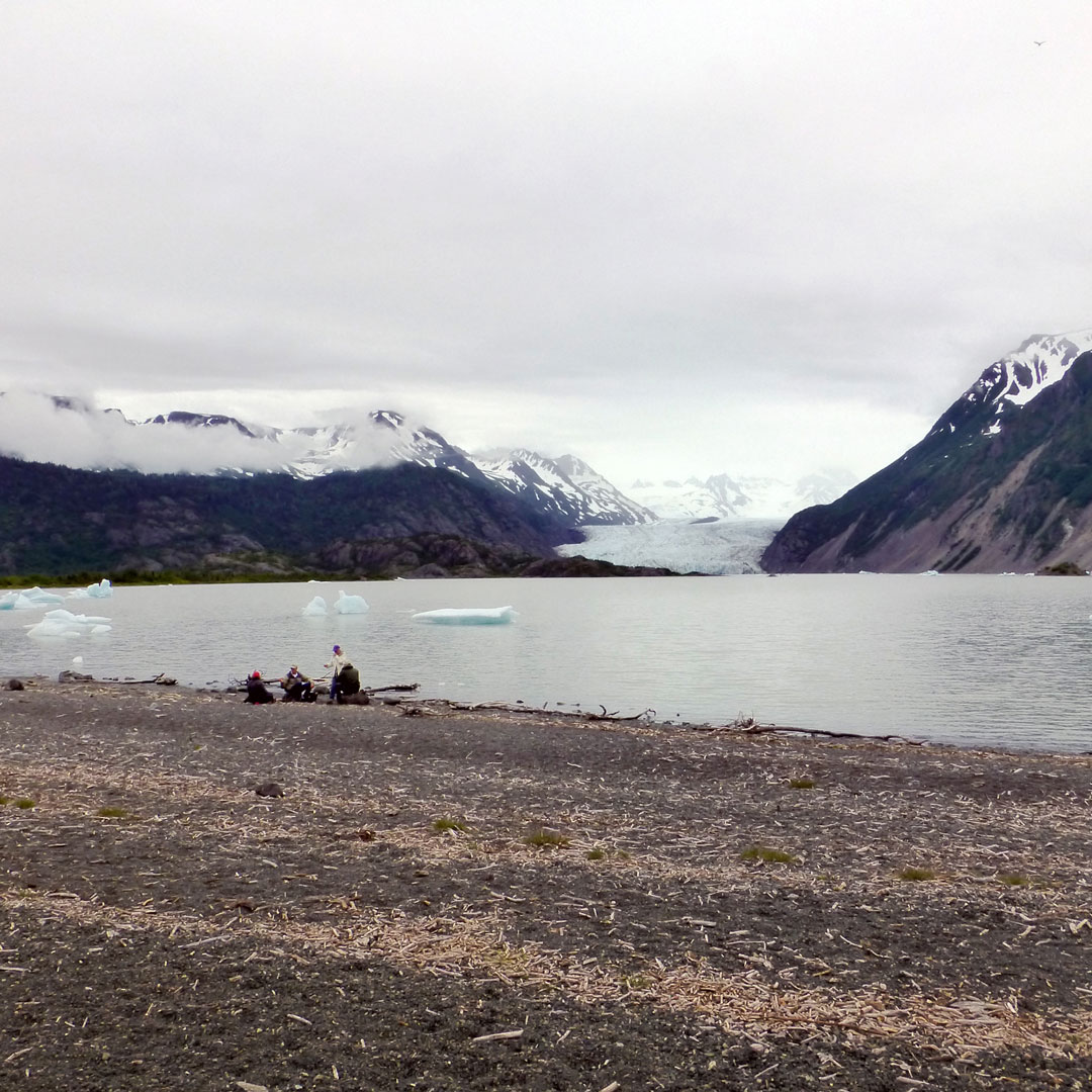
Without a doubt the most popular hike in Kachemak Bay, this trail is just outside the artsy fishing town of Homer. But there’s a very Alaska catch: You have to take a boat to get there. You’ll find water taxis up and down the Homer Spit that are happy to give you a ride to the trailhead (for a fee) and then pick you up at the Saddle trailhead. All told it’s an easy, 4.5-mile walk to the shore of Grewingk Lake (with the glacier brooding on the far side) and then out to your pick-up point at the Saddle trailhead in misty Halibut Cove, with gorgeous wildflowers bordering the trail along the way.
Raven Glacier
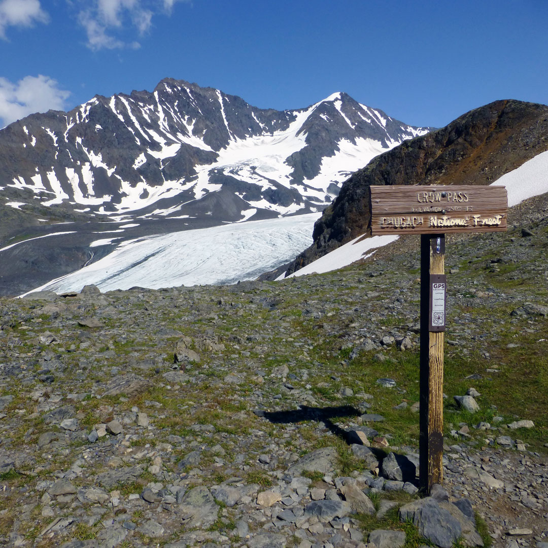
Starting from the end of Crow Creek Mine Road in Girdwood, this trail covers the first 4 miles of the iconic 24-mile Crow Pass trail from Girdwood to Eagle River. But as anyone who’s done the entire trail can tell you, these first miles are the best and prettiest, taking you past old mining equipment to the tundra shores of Crystal Lake and then on to the pass and its overlooks of Raven Glacier.
Reed Lakes
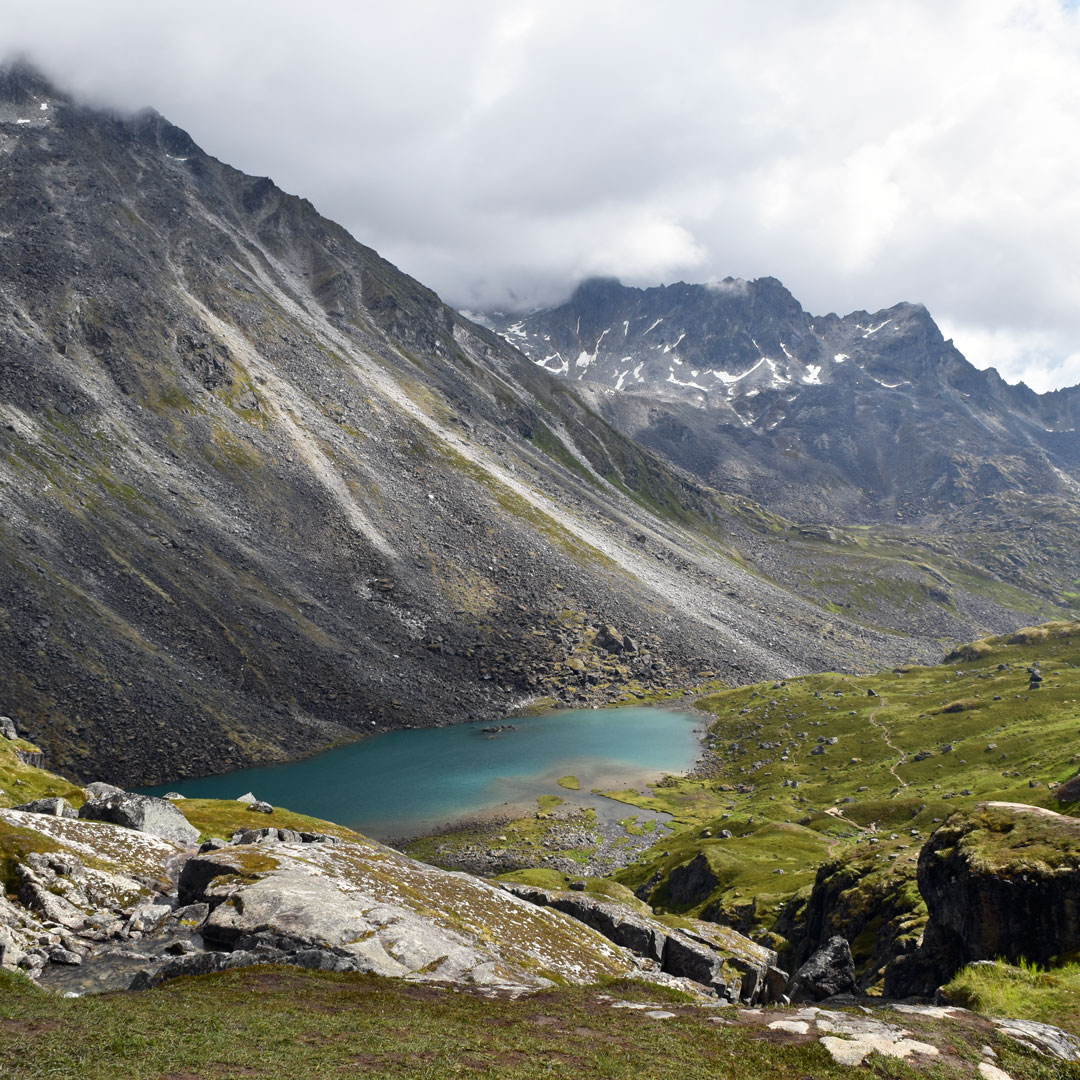
This 9-mile round trip is the most iconic of all the hikes in Hatcher Pass, a wonderland of rolling tundra dotted with massive granite boulders strewn like playthings by the passage of long-vanished glaciers. You’ll have to hop through some of those car-sized boulders to reach the two lakes that give this hike its name, with the tumbling sheet of a small waterfall between them—but it’s well worth the effort. This trail starts at mile 2.4 of the rough, unpaved Archangel Road.
Exit Glacier and Harding Icefield
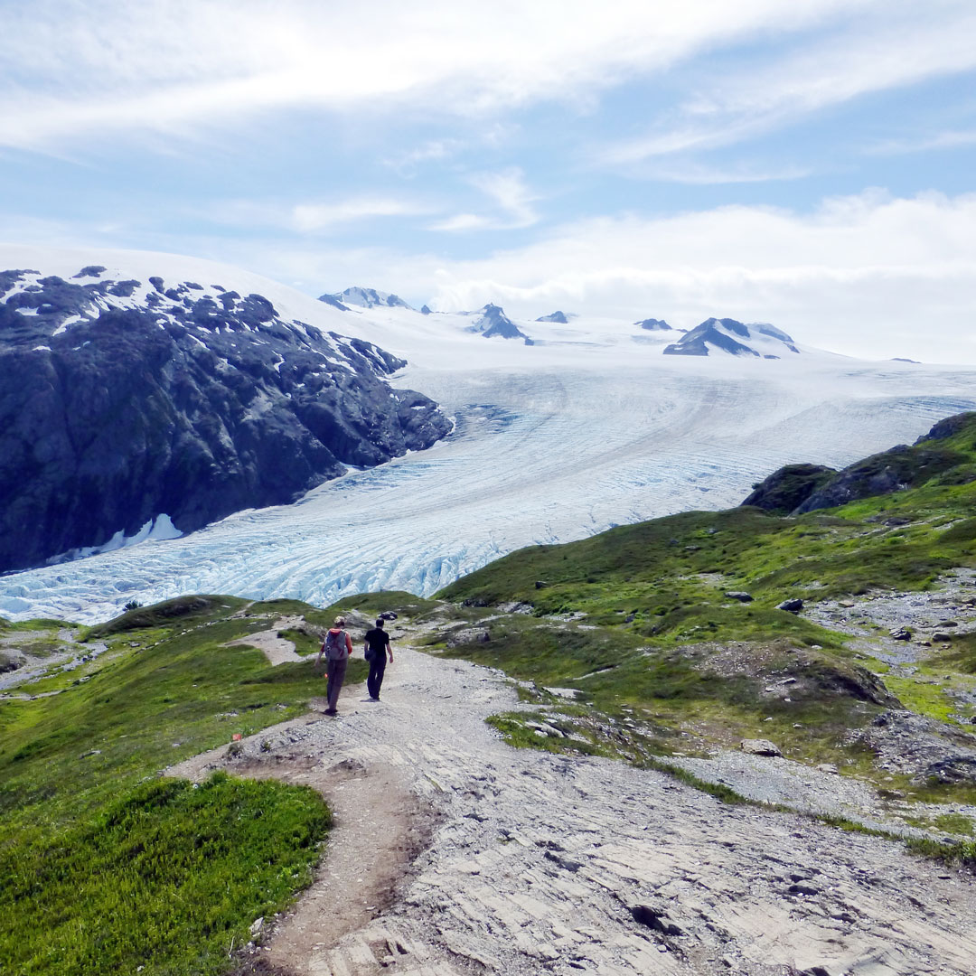
Both of these trails start at the Exit Glacier Nature Center just outside Seward—and in fact, they overlap for the first .4 miles. But after that, their characters become very different. The Exit Glacier trail continues in an almost completely flat 2-mile loop, overlooking a glacial floodplain before ending at lookout platforms that used to be within arm’s reach of the gradually retreating ice. Meanwhile the Harding Icefield trail charges uphill for a challenging 9-mile round trip, but if you’re made of stout enough stuff, the views of the icefield—a massive sheet of snow and ice that spawns some forty glaciers, including Exit Glacier—are incomparable.
Newsletter Signup
By clicking ‘Sign Up,’ I acknowledge that I have read and agree to Hachette Book Group’s Privacy Policy and Terms of Use
Pin For Later