One-Week Best of Death Valley Itinerary
This detailed one-week Death Valley itinerary covers the area’s most popular sights, notable landscapes, hikes, and more. You’ll have options for hotels and camping along the way, and you will need a car to make the drive to and through the valley.
Day 1
Fly into Las Vegas, Nevada, and rent a car for the road trip to Death Valley. From Las Vegas, travelers will access the eastern side of the park, a drive of about 2.5-3 hours (150 miles) to the park hub of Furnace Creek.
Day 2
Set yourself up in Furnace Creek, the main park hub, to enjoy Death Valley’s most iconic sights. The casual Ranch at Death Valley and the upscale Inn at Death Valley are your only accommodation options. Texas Spring is the most scenic campground, but it can get crowded; make sure you’ve lined up your space early.
Just south of Furnace Creek, Badwater Road offers a scenic driving tour. Fill up with breakfast at The Wrangler or the 49’er Café in Furnace Creek before heading out. Your first stop is Golden Canyon, where you can beat the heat (and the crowds) with a lovely morning hike.
Continuing south along Badwater Road, take a quick side trip to enjoy the relaxing and scenic drive along Artist’s Drive and through the colorful, jumbled rock formations.
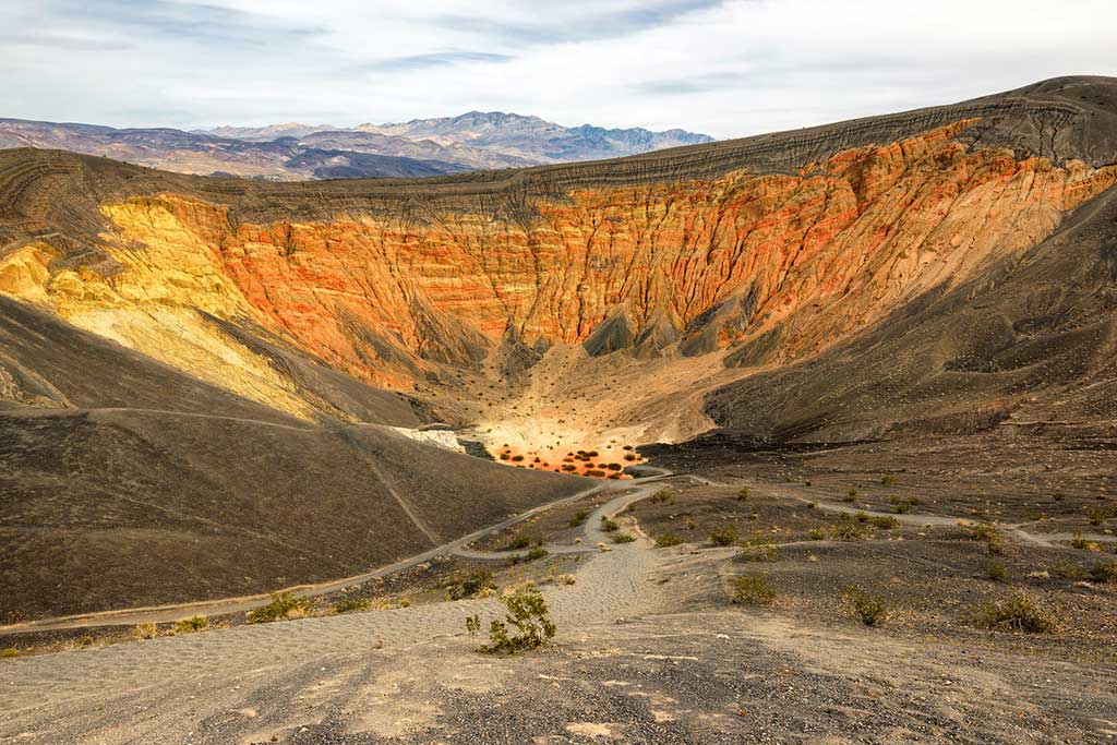
Just over 6 miles south of the Artist’s Drive exit along Badwater Road, the Devil’s Golf Course surprises with its bizarre salt formations, but you can only see these if you stop and get up close.
Two miles south is the turnoff to an easy stroll through impressively large Natural Bridge. Continue 4 miles south on the park road to admire Badwater Basin’s surreal salt flats, 282 feet below sea level and the lowest point in North America.
From Badwater, turn around and retrace your route north to the junction with Highway 190 and turn right (east). Follow Highway 190 to its junction with Dante’s View Road to end at Dante’s View after 22 miles for sweeping views of the valley below. Retrace your steps and make a detour through Twenty Mule Team Canyon 17.7 miles north of the viewpoint. Finish your scenic driving tour at Zabriskie Point for more spectacular views of the valley below and up close views of the eroded badlands below the point.
Leave yourself enough time to enjoy the warm spring-fed pool at the Ranch before heading to dinner. Reserve a table at the Inn at Death Valley for a sunset meal at one of the outdoor tables or in the historic dining room. The Inn also has a cocktail lounge where you can enjoy the same view.
Day 3
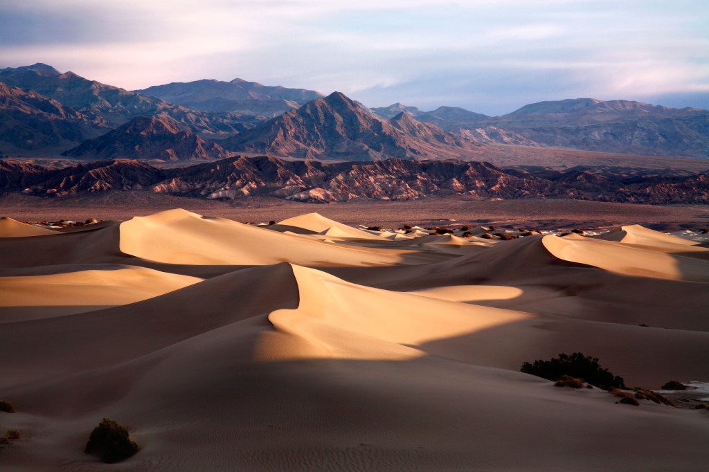
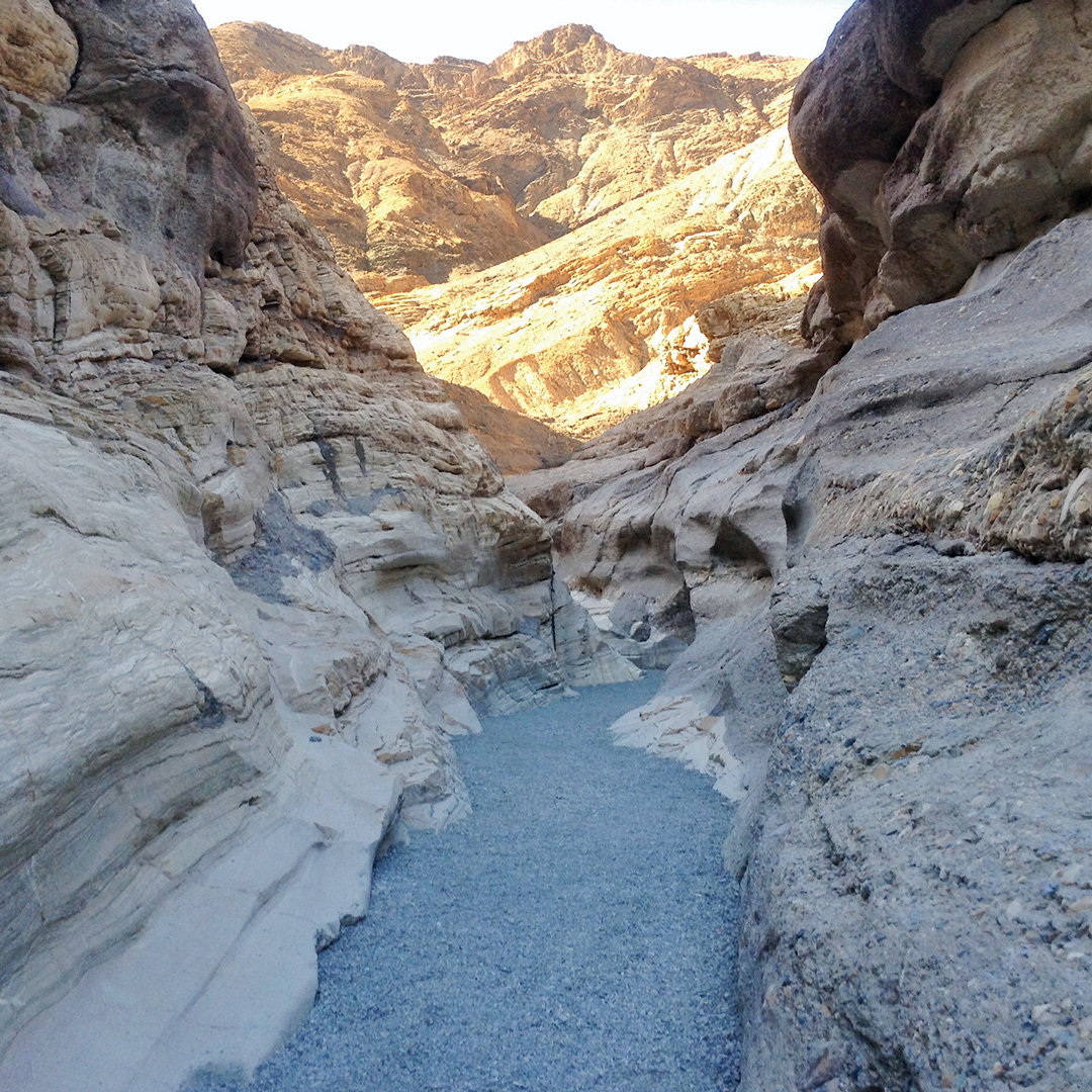
Today, explore the Stovepipe Wells and Nevada Triangle region. The short hike through Mosaic Canyon is a great introduction to the canyons—wander through polished marble, colorful mosaic stone, and satisfying narrows. Just across Highway 190, the sculpted sand dunes of Mesquite Flat are visible from Stovepipe Wells, but are definitely worth a closer view.
From Stovepipe Wells, head east for 26 miles along Daylight Pass Road to Beatty, Nevada, the jumping-off point for your next adventure. Beatty is a good place to fill up on gas and food. Try the Happy Burro Chili & Beer, a charming saloon-style bar and restaurant with an outdoor patio.
The ghost town of Rhyolite is just four miles west of Beatty. Wander the impressive ruins of this once-rich gold mining town, then stop at the Goldwell Open Air Museum next door to peruse the hauntingly beautiful outdoor art exhibits set incongruously against the desert backdrop.
The crowning point of your day will be driving the Titus Canyon Road—the most popular backcountry route in Death Valley. The one-way access point begins 2.1 miles south of Rhyolite, just off Daylight Pass Road. The washboard road winds 27 miles past rugged rock formations, sweeping canyon views, petroglyphs, and even a ghost town to eventually end at Scotty’s Castle Road, 20 miles north of Stovepipe Wells.
End your day with a celebratory drink at the Badwater Saloon back in Stovepipe Wells Village. Enjoy a dip in the pool or a casual dinner before retiring to one of the basic motel rooms.
Newsletter Signup
By clicking ‘Sign Up,’ I acknowledge that I have read and agree to Hachette Book Group’s Privacy Policy and Terms of Use
Day 4
You’ll need an early start to explore Scotty’s Castle and Eureka Valley. Pack your car with all the food and water you’ll need for a full day, and bring your camp gear.
Continue north to the Eureka Dunes, a drive of nearly 50 miles from Mesquite Spring Campground. It’s a two-hour haul to the northernmost destination in the park, but it’s well worth it to enjoy the isolated and pristine setting. The Eureka Dunes are the tallest dunes in Death Valley, rising from the Eureka Valley floor and framed by the Last Chance Range.
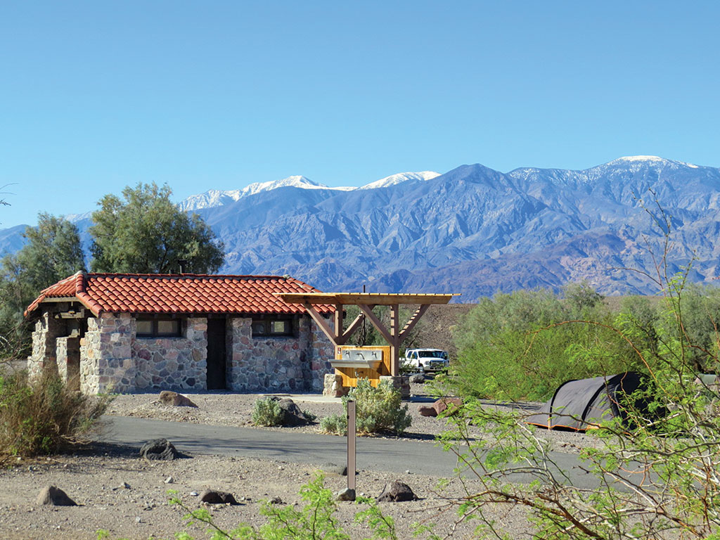
When you’ve had your fill, head back down to Scotty’s Castle Road (a one-hour drive) and camp at Mesquite Spring. The sites at this quiet, pretty campground are dotted with its namesake trees and sheltered along a wash. If you’re not camping, Stovepipe Wells has the closest accommodations, but this will add an extra hour of driving.
Day 5
Today’s destination is the Racetrack Valley. (If you’ve camped at Mesquite Spring, you’re well positioned for this trip.) The long, gravel high-clearance Racetrack Road begins just beyond Ubehebe Crater. Make a quick pit stop at this colorful volcanic overlook before heading south toward the Racetrack Valley. The destination for most people is the Racetrack, 26 miles in.
At 19 miles, the colorful Teakettle Junction signpost comes into view. Take a left turn at Teakettle Junction for a quick detour to the picturesque and weathered cabin of the Lost Burro Mine (at 3.2 miles, you will reach a four-way junction; park and walk along the right spur, which ends at the Lost Burro Mine in 1.1 miles).
Head back to Racetrack Valley Road and turn left to continue to The Racetrack. This dry lake bed, or playa, is famous for its moving rocks, which glide across the surface and leave mysterious trails. Soak in the surreal sight, then tackle the ambitious hike to Ubehebe Peak. The trail starts at The Grandstand parking area, then switchbacks up the side of the mountain with increasingly spectacular views of the Racetrack and the surrounding valley. Leave enough time for the hike back down and the long drive back out.
Spend another night camping at Mesquite Spring, or drive the 66 miles (1.5 hours) south to the Panamint Springs Resort on Highway 190. Tuck into a rustic cabin, motel room, or campsite and enjoy a relaxing dinner on the stone patio. Swap stories of your day’s adventure with the other visitors at this friendly outpost on the western side of the park.
Day 6
Fill up on breakfast at Panamint Springs before heading out for a full day of exploring and hiking in the Emigrant and Wildrose Canyons on the western side of the Panamint Range. The first stop is the historic Wildrose Charcoal Kilns. Once used to make charcoal for the mining efforts in the area, they now stand as works of hand-engineered beauty.
The Wildrose Peak trail starts from the Charcoal Kilns parking area. This colorful forested trail leads through juniper trees to a big payoff at Wildrose Peak and its panoramic views.
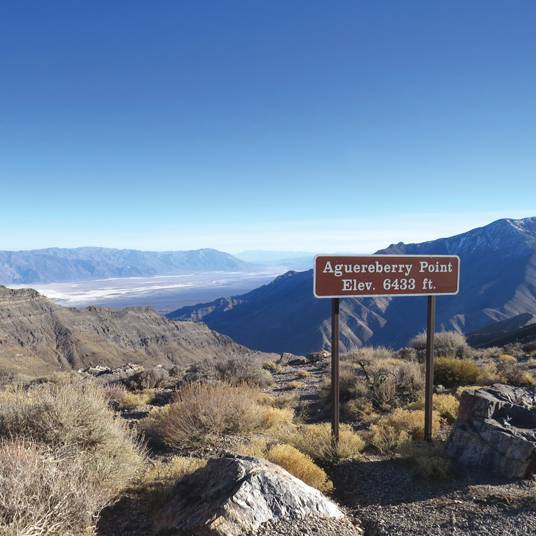
Wind down with two final stops on your way back to Panamint Springs Resort. Located off Aguereberry Road, Aguereberry Camp provides a great perspective of a small mining camp and life in the desert. Enjoy the spectacular views from Aguereberry Point across Death Valley below.
You’ve definitely earned your relaxing dinner at Panamint Springs Resort after this day. If you’re camping, Wildrose Campground is a great choice, tucked away in Wildrose Canyon.
Day 7
From Panamint Springs, it’s about 50 miles west to Lone Pine, an outpost of civilization on U.S. 395 and your western exit from Death Valley. Spend a few hours exploring the town before driving south to Los Angeles (3 hours, 200 miles) or return to Las Vegas (5 hours, 300 miles) for your flight home.
Newsletter Signup
By clicking ‘Sign Up,’ I acknowledge that I have read and agree to Hachette Book Group’s Privacy Policy and Terms of Use
Pin it for Later